
LCT 12: Levels Farmland
View East – Stubbs Bridge
Location and Summary
The Levels Farmland LCT is located in the south of the study area, forming the north-western part of the Humberhead Levels and a portion of the Vale of York.
The landscape is predominantly flat, arable farmland of medium to large fields interspersed by small blocks of woodland and a number of villages. Located within the Selby Coalfield, modern and industrial features have an overarching influence on the landscape, including the Drax Power Station and (disused) Eggborough Power Station and associated pylons, highways including the M62, A63 and A19, railway lines converging on Selby and Leeds East Airport.
The boundaries of this LCT are defined to the west by the low ridge of the Southern Magnesian Limestone Ridge (LCT 11). It is divided into three by the low-lying river floodplains of the River Wharfe, River Ouse, River Derwent and River Aire (LCT 13 River Floodplains). To the north-east, the landscape becomes more wooded (LCT 14 Vale Farmland with Plantation Woodland).
Landscape character areas (LCAs) within this type
LCT 12 Levels Farmland is divided into 3 Landscape Character Areas:
- LCA 12A – Eggborough Levels
- LCA 12B – Sherburn in Elmet to Selby Levels
- LCA 12C – North Duffield to Hemingbrough Levels
View interactive map help
Key Characteristics
- Flat, low-lying landscape with occasional prominent mounds associated with industry and embankments associated with motorways and A roads.
- Mineral-rich soils within a historically wet landscape, heavily engineered to create farmland through linear drainage channels, dikes and ditches.
- Ancient woodlands and woodlands create pockets of habitat and recreational value. Trees are skyline features in the flat, open landscape and often define the horizon.
- Arable farmland of medium-large fields, with a fragmented hedgerow network.
- A settled landscape with the town of Selby, a pattern of linear and nucleated villages and scattered properties/farmsteads set on higher ground.
- A landscape largely defined by historic and modern agriculture and industry, including the influence of coal extraction across the Selby Coalfield.
- Large scale and visually prominent infrastructure, including industrial sites such as Drax Power Station, pylons and major transport routes (M62, A19 and A63), is embedded with the flat landscape and forms prominent landmarks.
- A loosely connected network of footpaths focus access to the landscape around settlements and major woodlands such as Bishop Wood.
- The flat, low-lying topography which contrasts with vertical elements such as pylons and cooling towers which are prominent and visible across long distances.
View West – Burn Airfield

Landscape Description
Natural Influences
Geology, soils, topography and hydrology
The Levels Farmland LCT is a predominantly flat, low-lying landscape. It is underlain by Permo-Triassic mudstone, sandstone and siltstone bedrock, but shaped by the clay and silt deposited by Lake Humber during the last ice age. These laminated silts and clays smoothed the landscape and created the flat topography seen today, predominantly between 5 and 10m AOD.
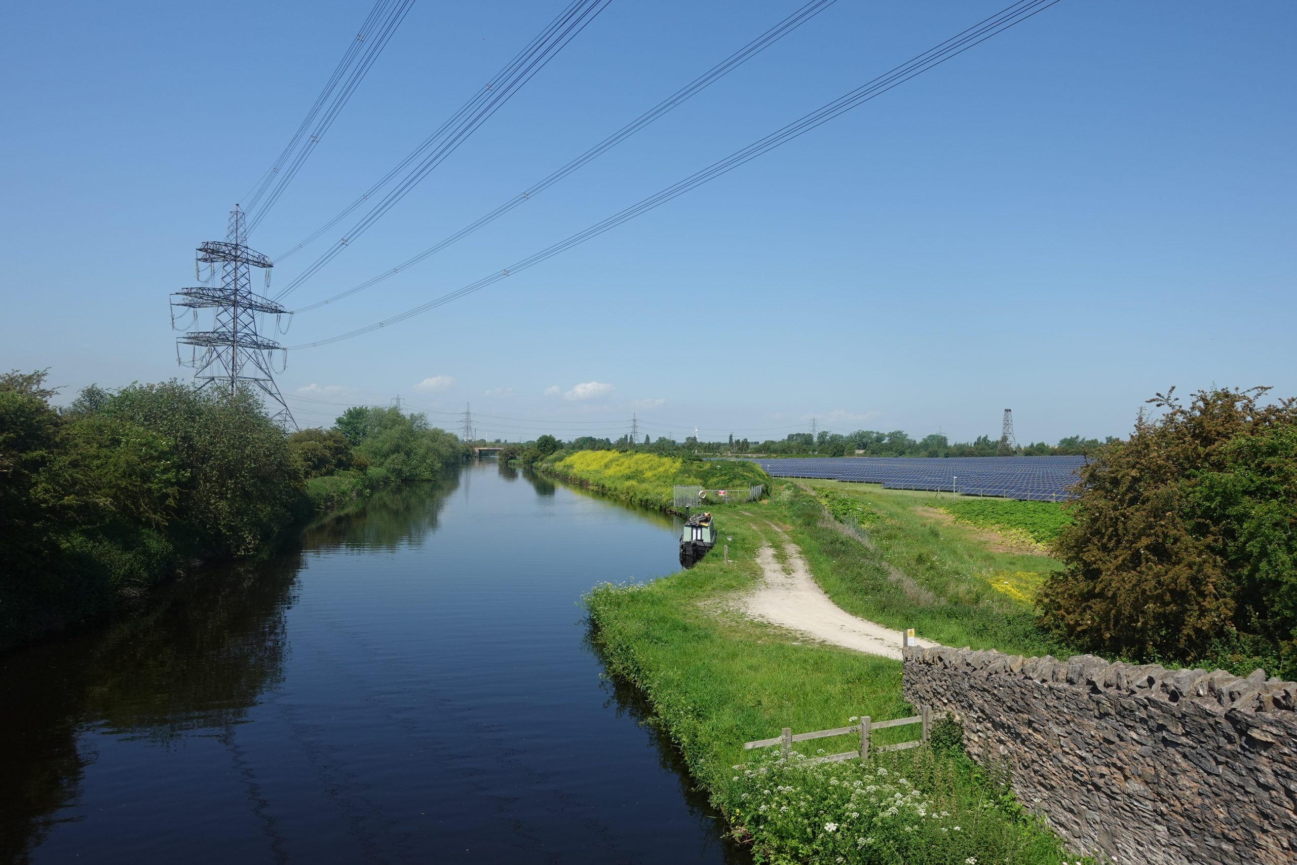
The landscape comprises the wider floodplains of the Rivers Ouse and Aire. This landscape would have historically been very wet, with areas reaching below the mean high-water mark. However human intervention in the form of linear irrigation channels, dikes, and ditches, has drained the area to support widespread productive farmland. The Selby Canal provides a connection between the River Ouse and River Aire, and the Aire and Calder Navigation is a canalised section of the rivers.
Selby Coalfield, a series of deep coal mines, operated between the 1980s and early 2000s. Occasional isolated mounds are found to the north-west of Drax Power Station (30m AOD), and at the Gale Common Ash Disposal Works (69m AOD). These landforms are the result of material deposit during historic industrial use and are visible in long distance views across this otherwise flat, simple landscape.
Semi natural habitats and tree cover
A disconnected patchwork of generally small woodland blocks, including some ancient woodland, provide habitat, a sense of naturalness and localised enclosure. Most notable is Bishop’s Wood, a large woodland to the west of Selby. Areas of woodland are often associated with infrastructure, such as adjacent to Eggborough Power Station (LCA 12A), Drax Power Station (LCA 12B) or as a result of decommissioning or disuse of sites for example Gale Common Ash Deposit works (LCA 12A).
Small areas of floodplain marsh occur within the landscape; most notably along the banks of the River Went to the south (LCA 12A) and along the River Derwent and extending into flat low-lying areas of farmland to the north of Cliffe (both in LCA 12C) to the east. The Kirkby Wharfe Site of Specific Scientific Interest (SSSI) is important for marshland plants relating to Dorts Dike, located to the east of Kirkby Wharfe (LCA 12B).
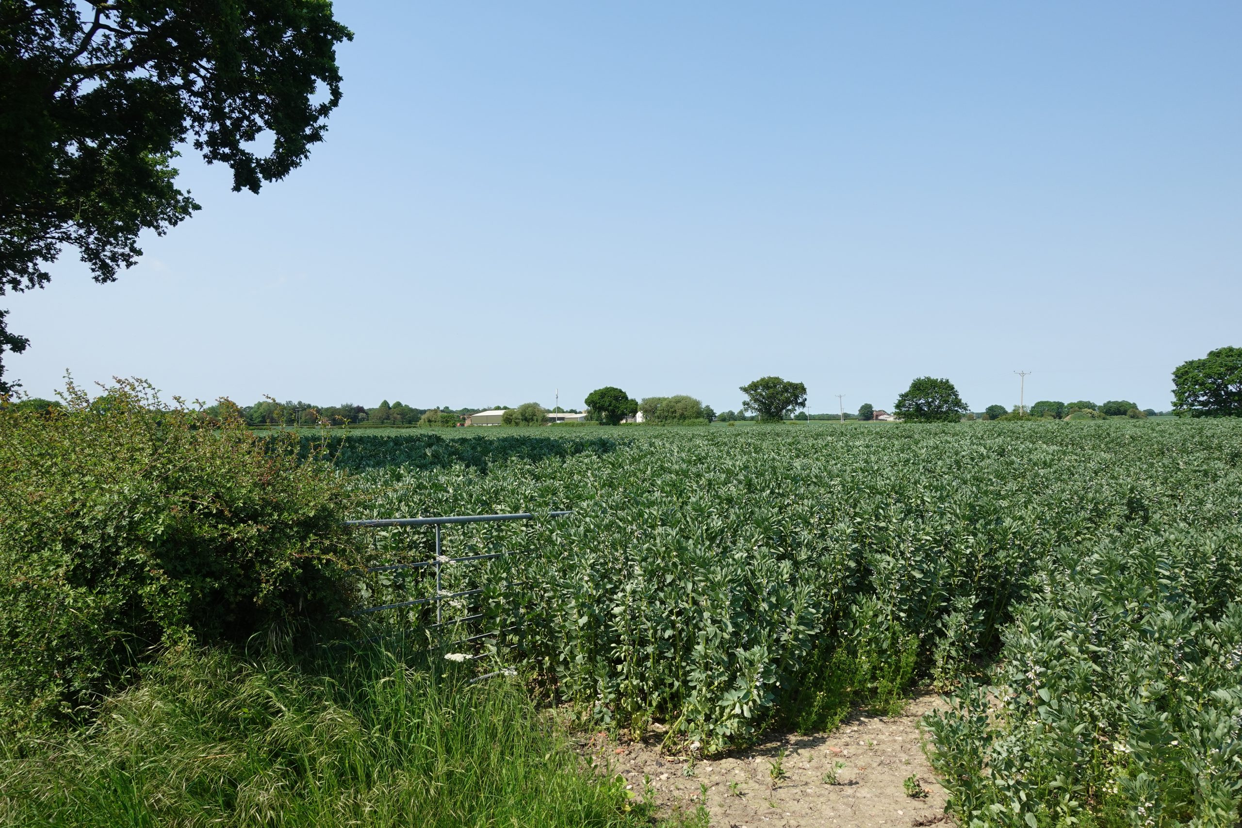
Hedgerows are fragmented, with boundaries often defined by ditches, and hedgerow trees and infield trees occur occasionally, more commonly at farm extents and along roads. Whilst sparse, trees and woodland often define skylines across this open, flat landscape.
View East – Greengate Lane
Cultural Influences
Land use, enclosure and field pattern
Arable fields are medium to large, bounded by drainage ditches or fragmented and low cut, often hawthorn, hedges. Larger, regular fields of modern origin occur throughout as a result of field amalgamation since the late 19th century. Some areas of planned large scale parliamentary enclosure appear adjacent to the settlements of Selby, Church Fenton, and Eggborough. Arable farmland is occasionally interspersed with areas of pasture associated with settlement and floodplains.
Extensive areas are occupied by industry, most notably the Drax Power Station. Several operational airfields, such as Sherburn in Elmet, Leeds East Airport (formerly RAF Church Fenton) and Burn (Selby) Airfield, are distributed across the west and centre of the LCT.
Historic and cultural character
Historic interventions to manage water are still visible across the landscape include dikes, former windmills, and linear drainage channels. Locally important historic records largely relate to the drainage of the farmland.
The landscape contains a number of historic, linear settlements, with conservation areas designated at the medieval villages of Monk Fryston (LCA 12B), and Womersley (LCA 12A). Elsewhere, modern expansion elsewhere has eroded historic character.
The sites of the former Wistow Mine, Gascoigne Wood Mine (LCA 12B), and Whitemoor Mines (LCA 12C) remain as either disused or repurposed industrial areas. Cooling towers such as at Drax are, for some, an iconic 20th century symbol of brutalist modernism, and a landmark in the wider landscape.
Historic and cultural character
Arable fields are medium to large, bounded by drainage ditches or fragmented and low cut, often hawthorn, hedges. Larger, regular fields of modern origin occur throughout as a result of field amalgamation since the late 19th century. Some areas of planned large scale parliamentary enclosure appear adjacent to the settlements of Selby, Church Fenton, and Eggborough. Arable farmland is occasionally interspersed with areas of pasture associated with settlement and floodplains.
Extensive areas are occupied by industry, most notably the Drax Power Station. Several operational airfields, such as Sherburn in Elmet, Leeds East Airport (formerly RAF Church Fenton) and Burn (Selby) Airfield, are distributed across the west and centre of the LCT.
Settlement pattern and infrastructure
The landscape is well settled, with Selby forming the principal market town and largest settlement. Elsewhere, settlement is more dispersed, with a mixture of linear, small villages, such as Drax, Burn, Monk Fryston, Whitley, and Cliffe and larger nucleated settlements, such as Sherburn in Elmet, Thorpe Willoughby and Carlton. Many settlements experienced expansion during the post-war period, in association with the development of mines and large power stations, for example at Eggborough and Sherburn in Elmet. Between villages, farmsteads are widespread, reinforcing the settled rural character.
Major transport routes include the M62, the A19, and the A63, which provide strong east-west and north-south connections across the landscape. Railway corridors converge on Selby, reflecting its historic role in coal transportation and its strategic location between Leeds and Hull, and London and the north of England. Remnant of former rail infrastructure remain evident within the landscape, including dismantled railways in LCA 12C, east of Osgodby and LCA 12B, north of Stubbs Walden.
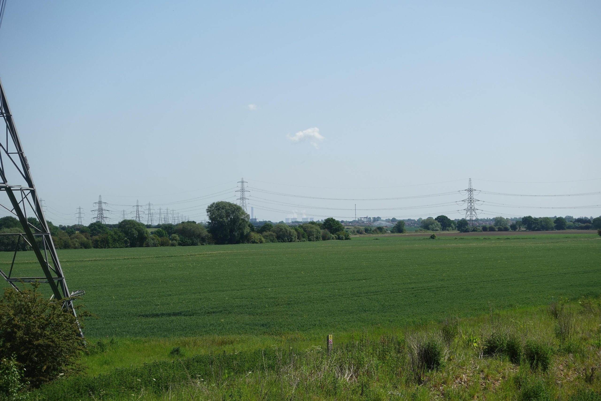
Several large overhead power lines cross the landscape, extending from Drax Power Station (LCA 13A), Eggborough Power Station (LCA 12A), and Monk Fryston Substation (LCA 11B).
Access and recreation
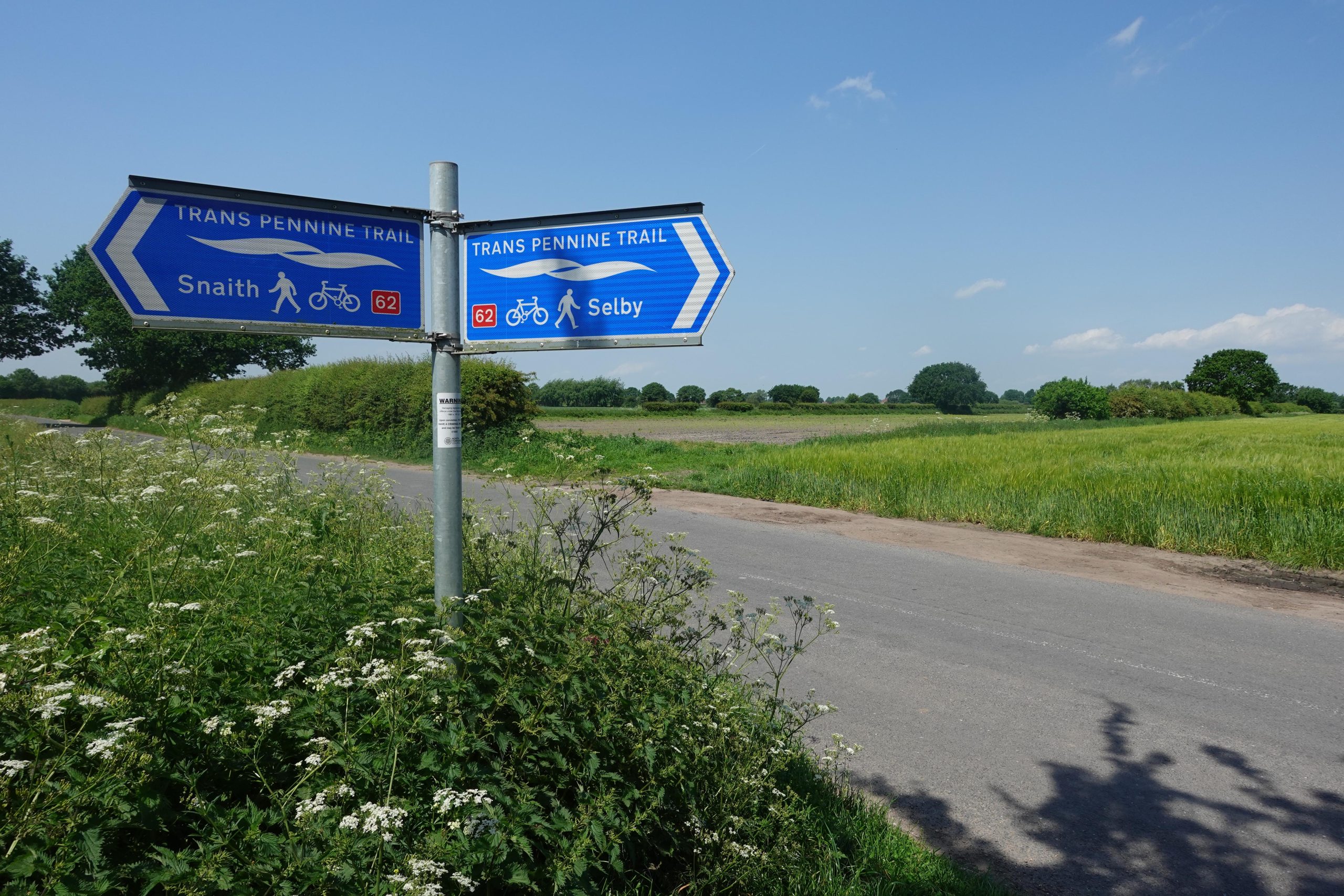
A network of public rights of way, including the Trans Pennine Trail connects settlements and individual farmsteads, with increasing density and connectivity in the north-west near Ulleskelf, Church Fenton, and Cawood. Access to the landscape is focused on settlements, and within the large woodlands including Bishops Wood and Brayton Barff. The Selby Canal provides access for walking, boating and cycling.
View North-West – Stubbs Bridge
Perceptual and Experiential Influences
Views and intervisibility
Due to the flat and open topography, views are open, particularly in areas with fewer hedgerows such as to the west of Gateforth. Woodland and denser hedgerows are prominent on the skyline, and sometimes create a localised sense of enclosure, particularly along roads, waterways, and adjacent to settlements. In the west, the rising landform of LCT 11 provides a backdrop of views.
Vertical features associated with historic extraction or power stations, such as the cooling towers and chimney stack at Drax Power Station and overhead pylons, are prominent landmarks across the wider landscape.
Experiential qualities
The simple, large-scale and open nature of the landscape has a consistent reminder of the area’s relationship to power and energy. This is particularly strong in proximity to power stations, pylons, and major roads such as the M62, A19 and A63.
Pockets of tranquillity and the darkest night skies are found in the east near the village of South Duffield (LCA 12C), and the north-west near to Bishop Wood (LCA 12B).
View South - Camblesforth Common

Evaluation
Key landscape and visual sensitivities
- Low-lying productive arable farmland which has value for food production.
- The historic pattern of drainage channels, dikes and ditches which underpins the structure of this flat landscape and contributes to its character.
- Woodland, including ancient woodland, which creates valuable pockets of habitat and space for recreation, for example Bishop Wood.
- Pockets of wetland habitat including marshland plants along Dorts Dike and floodplain grazing marsh along the River Went, which contributes to wider ecological networks.
- The historic settlement pattern of isolated farmsteads, small linear villages and larger nucleated villages, as well as the market town of Selby.
- Industrial heritage associated with coal mining which provides a link to the recent past, and the Drax cooling towers, an icon of 20th century modernism.
- Access to the landscape provides recreational value, through the public rights of way, Trans Pennine Trail and the Selby Canal.
- Open views across the arable farmland, with intervisibility with the Magnesian Limestone Ridge (LCT 11) to the west, which provides a dark backdrop to the LCT.
- The settlement pattern and low-lying farmland combine to create a strong sense of openness with big skies.
Forces for change
In addition to the generic forces for change set out in Chapter 4, the following apply to this LCT:
- Regeneration of decommissioned energy infrastructure including Eggborough and Drax Power Stations will have an impact on views across the landscape, particularly the removal of landmark 20th century cooling towers or chimneys and other vertical features.
- Pressures for expansion of housing on the edge of towns and larger villages such as Selby, Sherburn in Elmet, Eggborough and Hillam, which may affect the perception of dispersed settlements.
- New development within historic villages such as Monk Fryston and Womersley may be insensitive to the linear form of the village, vernacular materials and traditional building design.
- Pressure for the development of large scale industrial and commercial units (such as data centres and warehouses), particularly along the M62, A19 and A63, settlement edges and brownfield land, including former mines.
- Development for employment or restoration for nature of former mines such as Gascoigne Wood Colliery will alter the existing industrial/post-industrial character of these areas within the landscape.
- Pressure for renewable energy schemes, including solar farms and wind energy developments, as well as associated grid infrastructure, such as Yorkshire Green, which would introduce further prominent vertical elements to the flat landscape.
- Wetland habitats such as grazing marsh are increasingly under threat from arable conversion and reduced maintenance, leading to habitat degradation and loss of habitats for wintering and migrating birds.
- The structure and composition of ancient woodland such as at Bishop Wood is particularly vulnerable to increased prevalence of pests and diseases associated with climate change.
- Poorly maintained hedgerows have diminished traditional rural character, landscape structure and reduced their ecological function.
Guidance
Strategy
Protect the existing settlement pattern. Conserve open views across the flat, open landscape. Restore and connect woodland and wetland habitats including hedgerows to enhance landscape character and biodiversity. Development of brownfield sites should be designed to enhance habitat connectivity within the existing landscape framework.
Guidelines
In addition to the generic guidance provided in Chapter 4, the following guidelines apply to this LCT:
Landscape management
- Conserve and enhance open views, particularly where skylines are not broken by vertical elements and where there is a greater sense of tranquillity.
- Maintain and restore hedgerows through traditional methods.
- Protect and maintain valued semi-natural habitats, including blocks of woodland and wetland habitats at Dorts Dike and pockets of floodplain grazing marsh.
- Conserve the dispersed settlement pattern and linear nature of smaller villages, ensuring there is a sense of separation within the rural landscape.
- Plan for the improved integration of existing urban edges such as the western edge of Selby using tree and small-scale woodland planting.
- Provide sustainable recreational access to routes such as the Selby Canal, balancing this with the need to protect valuable habitats.
- Consider the potential for the disused railway east of Osgodby to be adopted as an active travel route, extending west from the Howden 20 at Gunby.
Development management
- Sensitively regenerate disused infrastructure and brownfield sites for biodiversity, and recreation benefits within the existing landscape structure, such as at Gascoigne Wood Mine.
- Prevent insensitive modern development that would erode the rural character of the landscape, particularly in the north-west and east where perceptions of tranquillity and dark skies are higher.
- Ensure industrial developments and any other large structures are of an appropriate size and location with robust landscape mitigation to screen and filter views towards the development.
- Consider cumulative impacts, sensitive siting and design of renewable energy developments and associated electricity infrastructure, particularly to avoid the perception of a ‘wirescape’, or numerous overhead electricity lines of discordant appearance in parts of the LCT already influenced by this type of infrastructure.
Landscape character areas (LCAs) within this LCT
The following provides a summary of the LCAs within the LCT, drawing out key distinctions between them. This summary should be read in conjunction with information contained above for the wider LCT:
LCA 12A – Eggborough Levels
View interactive map help
This LCA sits to the south of the River Aire (LCT 13 River Floodplain) and bound to the west by the rising landform of the Limestone Ridge (LCT 11 Magnesian Limestone Ridge). This landscape character continues southwards beyond the study area.
Similar in its character to the rest of the LCT, the LCA consists predominantly of flat arable farmland fragmented by infrastructure and industrial land uses, which are concentrated in the north. These include the former Eggborough Power Station, Gale Common Ash Disposal Works, pylons, a canalised section of the Aire and Cander Navigation, the M62, A16 and multiple rail lines. In the south, settlement is small scale, and perceptions of tranquillity increase.
The Gale Common Ash Deposit (69m AOD) is a prominent feature visible across the LCA, providing a stark contrast to the otherwise flat landscape.
View East – Stubbs Bridge
LCA 12B – Sherburn in Elmet to Selby Levels
View interactive map help
The largest in the LCT, this LCA comprising a broad area of flat arable farmland south of the River Wharfe and north of the River Aire (LCT 13B), and west of the rising landform of the gently rolling limestone ridge in the west (LCT 11 Magnesian Limestone Ridge).
Like the wider LCT, the landscape is dominated by arable fields with frequent, generally small-scale woodland blocks. There are more frequent towards the south-east in proximity to Camblesforth and Drax. In contrast, Bishop Wood is a large ancient woodland of Bishop Wood to the west of Selby.
This landscape is heavily influenced by the presence of large industrial facilities within or visible from the landscape, including Drax Power Station, the A63, several railway lines, pylons, former mines such as Gascoigne Wood Mine, employment development east of Sherburn in Elmet, Leeds East Airport and Selby Canal. In general, this is a more settled LCA, with the town of Selby in the east and large village of Sherburn in Elmet in the west. There is a pattern of smaller settlements in the north and south-west, and consequently stronger perceptions of tranquillity and darker night skies in these areas.
A registered battlefield north of Sherburn in Elmet, extending west into LCA 11B, marks the site of the Battle of Towton in the Wars of the Roses.
View North-East – Burn Airfield
LCA 12C – North Duffield to Hemingbrough Levels
View interactive map help
This LCA forms a small portion of the LCT to the east of Selby. It is bound to the east and west by the river floodplains of the River Derwent and River Ouse respectively (LCT 13 River Floodplain).
The LCA reflects the predominantly flat, arable character of the wider landscape. Hedgerow trees are a common feature of this LCA, in conjunction with a more intact hedgerow network than the rest of the LCT. Overall woodland cover is lower, with small shelter belts and limited woodland associated with settlement. There is a higher concentration of floodplain grazing marshes within this landscape, extending from the River Derwent (LCT 13 River Floodplain), and across farmland to the north of Cliffe.
This LCA has significantly less industrial land use, it is crossed only once by railway (plus a dismantled railway) and is characterised by small villages such as Cliffe, Osgodby and Hemingbrough. Consequently, perceived tranquillity and rural character is relatively strong. There are views towards prominent features in other LCAs, such as Drax Power Station to the south, contributing to a sense of industrial character.
View South-West – Greengate Lane
